|
CLEARNAV
TAKES THE POTENTIAL OF COCKPIT NAVIGATION TO NEW HEIGHTS.
The
ClearNav Flight Computer with Secure Recorder
An
integrated cockpit navigational instrument and display providing full situational
awareness for glider pilots.
|
|
Features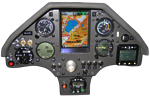
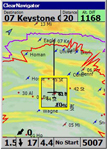
-
Glide
Amoeba dynamically displays alternate landing areas;
accounting
for altitude, terrain, glide performance and winds.
-
Focus
on flying with the Turn Area Task Management feature - stop making distracting,
constant adjustments and inputs in the air
-
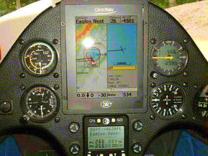
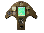
Right-Sized:
5 ½" diagonal display provides more than twice the viewing area
of a PDA yet mounts easily on or in front of the panel without obstructing
other instruments.
-
Bright:
So bright it has to be seen to be believed. Easily readable in full sunlight,
at all sun angles.
-
Adjustable:
Lowest brightness setting is still far brighter than any PDA but conserves
power while max setting provides visibility in even the most demanding
light situations.
-
Efficient:
Draws just 350 milliamps on lowest brightness setting up to 650 on max
brightness setting.
-
Sophisticated
software functions: The NK ClearNav comes preloaded with NK ClearNav software,
a highly evolved version of the proven Glide Navigator software. This software
offers
everything you would expect from advanced soaring specific
software
and more.
The
ClearNav's controls are so intuitive they can be operated by touch alone.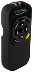
The
remote control module brings the buttons to the pilot, eliminating awkward
reaching.
(Stick
mounted option also available.) |
|
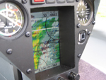
Glide
"amoeba"
ClearNav's
unique visual presentation
of
all areas you can reach given current conditions. This instantly understandable
graphical presentation of your landable footprint takes altitude, glider
polar, wind and terrain into account and also depicts your reachable footprint
above a user-settable arrival altitude.
|
|
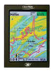
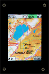
Moving
map with
selectable layers
Moving
map shows just the right degree of contour and terrain information, together
with clear display of airports and turnpoints.
User
settings allow you to show or suppress selected details as desired.
|
|
Task
optimization
Includes
intuitive area task
optimization
through clearly drawn turn point arcs.
|
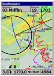
Airspace
monitor
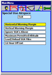
Visual
display of all SUA's, with audio proximity alarms and easily accessed details.
|
|
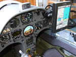
The
ClearNav is available with a selection of mounting options. Choose
the best method to fit your ship's needs.
|
|
| Behind
Panel Mount
|
|
| Through
Panel Mount
|
|
| On
Panel Mount
|
|
| RAM
Mount
|
|
Tunnel
Mount
 |
|
|
| We
are sure the ClearNav will be one of the best additions to your instrument
panel. If you have any questions, please do not hesitate to ask.
We've recently revised the Soaring
section of our website, updated our dealer listing and are still busy
making it better every day! We welcome your comments and suggestions.
Best
Regards, Clearnav
Soaring Customer Service Team |
|